

Weak steering currents, warm water, and a low-confidence intensity forecast
Latest forecast discussion on Tropical Depression Two

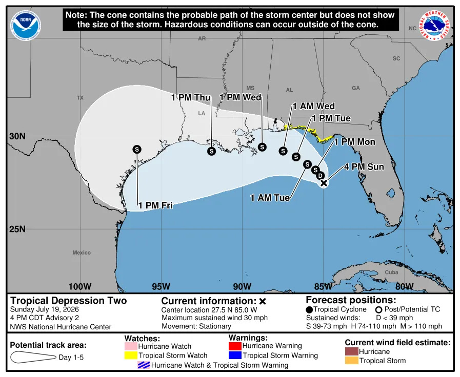
Tropical Depression Two formed Sunday morning over the northeastern Gulf and has done almost nothing since, drifting southeast over the past few hours instead of moving toward anyone. That’s about to change. NHC has it becoming a tropical storm Monday, then turning west and tracking along or just offshore of the northern Gulf Coast through the week. A Tropical Storm Watch already covers the Florida Panhandle, and Alabama, Mississippi, Louisiana, and Texas all need to be paying attention.
Synoptic setup
The depression is caught in a weak steering environment, wedged between a ridge over the western Atlantic, another ridge building over the south-central and southwestern U.S., and a trough digging into the Northeast. None of those features currently has a strong enough grip on the system to move it with any real speed, which is why it sat still today and even nudged southeast. That changes as the U.S. ridge strengthens and takes over as the dominant steering influence by Tuesday, setting up the west and west-northwest turn.
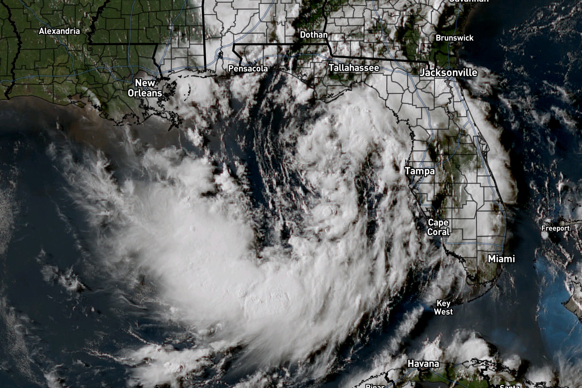
Working against organization right now: dry air intruding from the northeast, and northeasterly vertical wind shear (upper-level winds that tilt a storm’s structure and disrupt strengthening). The circulation itself is also large and somewhat diffuse, with shower activity spread across much of the eastern Gulf rather than tightly wrapped near the center. Recon and ASCAT data both put peak winds around 25 knots as of the afternoon advisory.
Timing
Monday: the system reaches tropical storm strength, and outer bands could bring tropical storm conditions to the Florida Panhandle late in the day. Tuesday: the west/west-northwest turn takes hold as the U.S. ridge builds east. Wednesday through Thursday: track continues along or just offshore of the northern Gulf Coast, with shear potentially relaxing midweek, which matters a lot for how strong this gets (more on that below). By day five, guidance brings the system near the upper Texas coast before it weakens inland.
The intensity question
This is the real story with TD Two. NHC’s official forecast brings it to 60 mph by 72 hours, roughly strong tropical storm strength, but the agency is explicit that this is a low-confidence call. Model guidance spans an unusually wide range: some solutions keep this a tropical depression the entire time, others spin it up to hurricane strength. The official forecast splits the difference and leans toward the stronger end of that spread, but the deciding factor is something models struggle with, how much time the center spends interacting with land versus staying over that 85 to 86 degree Gulf water. More time over open water and less shear midweek both favor stronger. More land interaction caps it. Nobody has high confidence in that balance yet.
Threats and impacts
Flash flooding is the widest-reaching threat, possible through Thursday from western Florida into southern Alabama, Mississippi, and Louisiana, largely independent of how strong the wind field ends up. Storm surge is forecast for the Florida Panhandle specifically, 1 to 3 feet of inundation from Indian Pass to Chassahowitzka if peak surge coincides with high tide. Wind impacts scale directly with the intensity uncertainty above, but even a weak tropical storm moving slowly along the coast can produce a prolonged wind and rain event.
Confidence and what could change
Pattern confidence is solid: this becomes a tropical storm Monday, and the west turn Tuesday is well supported by the ridge building over the U.S. Placement confidence along the coast late week is lower, since the track still depends on exactly how that ridge sets up. Intensity confidence is the lowest of the three, watch for updates on shear relaxing midweek and how close to the coast the center tracks, since either one could shift this meaningfully in either direction.